kmz files to view in Google Earth
If you click on one of these Google Earth should come up with the
overlay. It make take a little while for the overlay to come up.
While it is loading you will probably see a rectangle on the ground with an 'X' on it.
It may be that your browser will download the kmz file instead of launching
Google Earth. You can also download by right-clicking the link and
choosing "Save target as..." Then you can click on the
downloaded file to launch it.
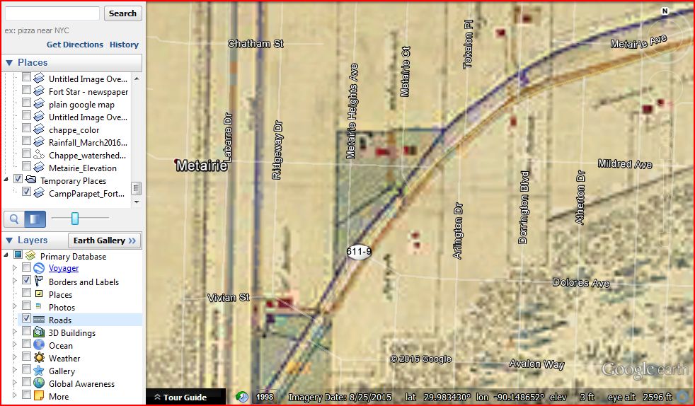
Once it is loaded you can zoom in and out, fade the overlay in and out over the
background, and with the 'roads' selected as the active overlay you can fade them
in and out over the maps. (see the end of this page)
CampParapet_FortStar_1863_kmz_file
an original file of this map can be found at https://commons.wikimedia.org/wiki/File:CampParapetMap1863-4.jpg
Maunsel_combo_kmz_file
Two map images posted on Facebook by Maunsel White were merged together at the
red line to provide a larger area to register to the background in Google Earth
FortStar_aerial_newspaper_kmz_file
From a newspaper article posted to Facebook. The aerial photograph is
aligned not the small inset map
Metairie_Elevation_kmz_file
Map generated from Gov't digital elevation data. Red is high; Blue is
low. Sea level is within green-blue transition. Note that Metairie
Ridge is actually a trough (where the bayou flowed) bounded by natural levees on
either side. Metairie Road has always followed the ridge of the southern
levee.
If this works out I will upload some other historic maps of the Metairie area.
-David
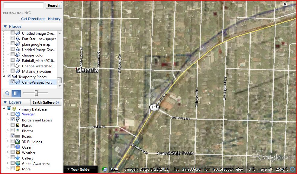
Instructions on fading overlays in Google Earth
The overlays control panel is on the left side of the Google Earth window.
There is a little shaded square just above where it says 'Layers'. If you
click on that you get a slider bar that allows you to fade an overlay or layer
in and out.
You can choose what feature the fader is controlling by clicking on he name of
the feature, this highlights it with a heavy blue bar.
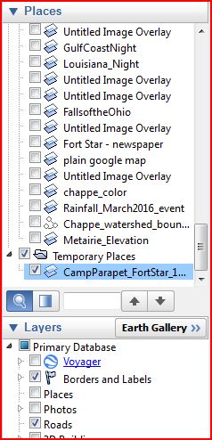
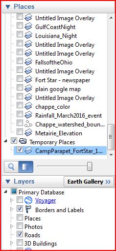
In the images below, CampParapet... is highlighted. In the image on the left the slider bar has been activated.
In this example the roads have been faded:
In this example, the overlay has been faded: